|
|
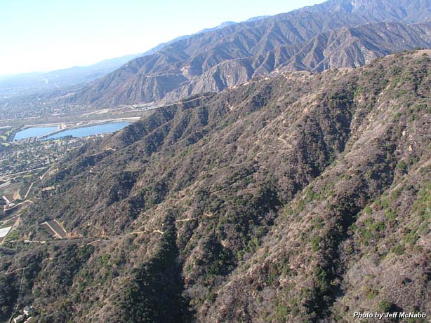
Garcia Trail - 1-3-04 as viewed and photographed by helicopter pilot Jeff McNabb, flying above Azusa and Glendora looking west. The top section of the trail is out of view in this shot as it contours over to the west side of the ascending ridge. The tan portion on the right top edge is Azusa Peak (2081'). On the left edge, portions of Monrovia Nursery can be seen. These plots have been vacated since this picture was taken and will host new homes in 2006. At the top of the photo is the alignment of three canyons: San Gabriel Canyon, Fish Canyon, and Van Tassel Canyon. At the mouth of Fish Canyon you can see the infamous quarry operation which thwarts access to Fish Canyon Falls.
|
|
Garcia Trail Page
|
|
Next
|
|
)