Dan's Hiking Pages: Hikes in the San Gabriels and Beyond
SimpsonCity Home   Hikes / Trails
  Dawn Mine
 
  Home
  About
  Hikes/Trails
  Hike Log
  Photos
  Hiking Tips
  Inspiration
  News
  Links
  Dan's Hiking Pages: Hikes in the San Gabriels and Beyond

Dawn Mine
via Sunset Ridge and Millard Canyon
Altadena / Angeles National Forest / Southern California

camera Photos: January 2007 and prior   Dawn Mine Hike Description

Dawn Trail to gold mine

Sunset Ridge Trail

Saucer Branch Falls

Dawn Mine
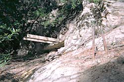
Dawn Mine - This abandoned mining equipment on the west bank of Millard Canyon marks the location of the mine.
Dawn Mine
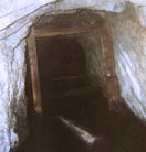
Dawn Mine - The tunnel is deemed unsafe to explore. The support timbers are rotting, the floor is covered with several inches of water, and there is a deep, water-filled vertical shaft about 40 feet in.


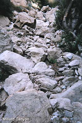
Imposing stretch of huge boulders


Dawn Station
Dawn Station - on the old Mt. Lowe Railway bed above Millard Canyon


Cape of Good Hope

View souteast toward Echo Mountain
Las Flores Canyon

Sunset Ridge Trail
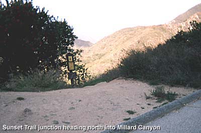
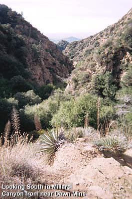
The trail zigzags and contours westward through lush chaparral and sections of tree-shaded forest into Millard Canyon.

Sierra Camp

Millard Map Dan at Dawn

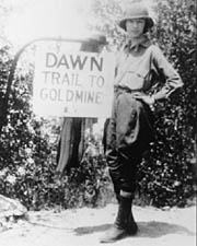
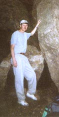
Dan at Dawn - 5-21-01, a gloomy day in May.

Standing at the entrance to the tunnel, which is not seen from the creek. You have to peek around these rocks to see the mouth of the mine shaft.

View souteast toward Echo Mountain
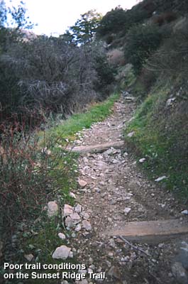
Sunset Trail Conditions (1-24-06) Much of the trail from the lower junction above the falls to the Cape of Good Hope are badly rutted and rocky.

Related links on Dan's Hiking Pages:

Last Hiked: January 24, 2007


Home | About Me | Hikes/Trails | Hike Log | Photos | Hiking Tips |
Inspiration | News | Links


SimpsonCity Home

Contact Dan Simpson
Entire contents © 1999-2014 Daniel E. Simpson
This page was last updated July 14, 2014.

icon