|
|
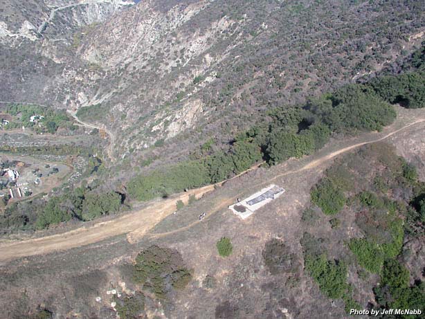
Garcia Trail - 1-3-04 as viewed and photographed by helicopter pilot Jeff McNabb, flying above Azusa looking north. Garcia Trail arrives at the ridge just out of view to the left of the photo. Azusa Peak (2081') is out of view just to the right. This concrete water collection slab is used for fire suppression. Beneath the slab is a reservoir. A hydrant is located in a concrete box next to the road (seen as a white square to the left of the two hikers. Note also the shadow from the helicopter).
On the left, on the other side of the ridge is an equestrian center just inside the mouth of the San Gabriel Canyon. At the very top of the photo we get a glimpse of Morris Dam and Reservoir.
|
|
Garcia Trail Page
|
|
 Previous |
Next Previous |
Next
|
|