Dan's Hiking Pages: Hikes in the San Gabriels and Beyond
SimpsonCity Home   Hikes / Trails
  Circle Bridge
 
  Home
  About
  Hikes/Trails
  Hike Log
  Photos
  Hiking Tips
  Inspiration
  News
  Links
  Dan's Hiking Pages: Hikes in the San Gabriels and Beyond

Mt. Lowe Railway Tour
Angeles National Forest / Southern California

Back to Echo Mountain hike desciption

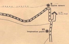
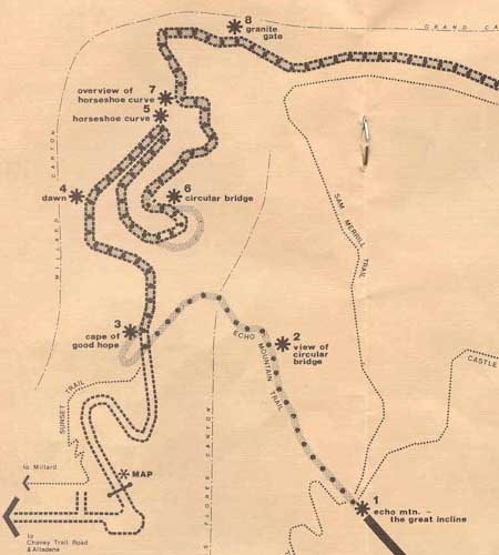
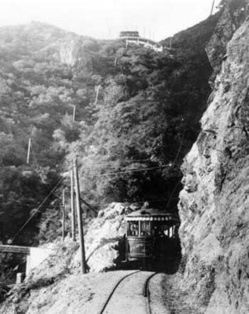
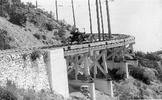
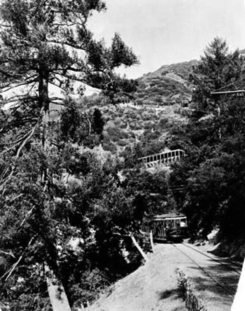
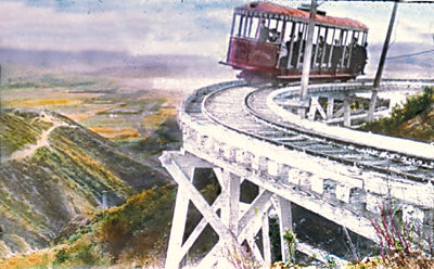
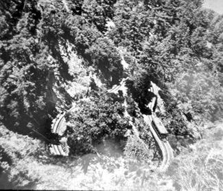
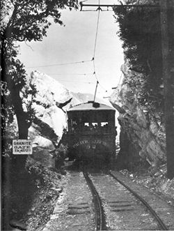
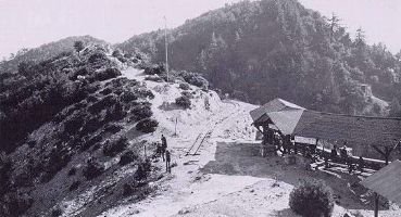
Railway bed Trail: This unique route follows the old rail bed of the Mt. Lowe Railway. The Forest Service and volunteers have created a self-guided tour featuring signs denoting 10 stations along the way.

Tour Cover Self Guided Hiking Tour of the
Historic Mount Lowe

Provided by The Scenic Mount Lowe Railway Historical Committee at mtlowe.net

View Brochure:
mtlowe.co/self_guided_tour.htm

View Pages:
Images copyrighted © 2002, Scenic Mt. Lowe Railway Historic Committee
Cover
Welcome
Introduction
Map
Station 1
Stations 2, 3
Stations 4, 5, 6
Stations 7, 8
Station 9
Station 10

Mt. Lowe Tour Map


Mt. Lowe Tour Map

Mount Lowe Railway Photo Tour
(mileage by Jerry Schad):


Echo Mountain
1 - (0.0) Echo Mountain

View of Circular Bridge
2 - (0.5) View of Circular Bridge

Cape of Good Hope
3 - (0.8) Cape of Good Hope

Dawn Station/Devil's Slide
4 - (1.0) Dawn Station/Devil's Slide

Horseshoe Curve
5 - (1.2) Horseshoe Curve

Circular Bridge
6 - (1.6) Circular Bridge

Horseshoe Curve
7 - (1.2) Horseshoe Curve Overview

Granite Gate
8 - (2.4) Granite Gate

Ye Alpine Tavern
9 - (3.4) Ye Alpine Tavern

Inspiration Point
10 - (3.9) Inspiration Point

Related links on Dan's Hiking Pages:


Home | About Me | Hikes/Trails | Hike Log | Photos | Hiking Tips |
Inspiration | News | Links

Facebook iconHiking in the San Gabriels by Dan Simpson | blogspotDan's Hiking Blog

SimpsonCity Home

Contact Dan Simpson
Entire contents © 1999-2014 Daniel E. Simpson
This page was last updated September 23, 2014.

icon