Forest Reopens Nearly All Remaining Closed Areas From Station Fire on Memorial Day Weekend
May 20, 2014
ARCADIA, Calif. - Forest Service officials will reopen on Saturday (May 24) nearly all remaining areas in the Angeles National Forest closed since the 2009 Station Fire. The reopenings during Memorial Day weekend of about 46,000 acres north of Altadena will offer additional summer recreation opportunities to the public including hiking, camping and picnicking.
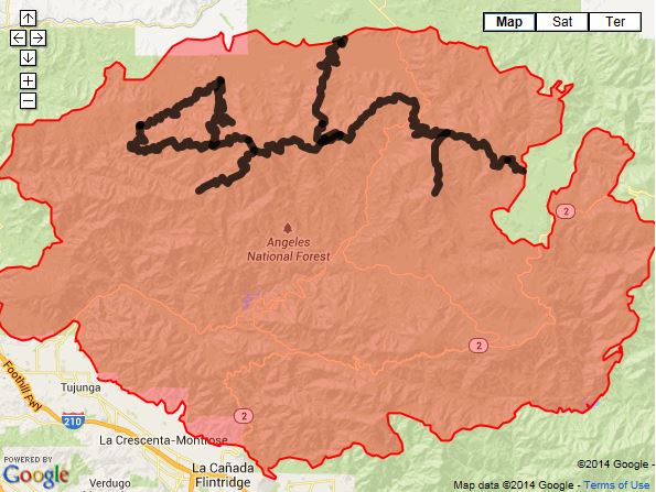 The black lines indicate road closures. The red zone represents the burn area from the 2009 Station Fire, which consumed 161,000 acres. |
The areas have been closed for public safety and to allow for new growth and planting of vegetation. The Forest Service has announced previous reopenings of certain areas since the fire that burned about 161,000 acres.
Some forest areas will remain closed for reasons of public safety or further work needed on trails.
Among the areas that remain closed:
- Lower Gabrielino Trail (below Bear Canyon Trail)
- Barley Flats Trail
- Colby Trail
- Ken Burton Trail
- Millard Water Fall User Trail
- Santa Clara Divide Road (FS3N17)
- Messenger Flats Campground
- Lightning Point Campground
- Big Buck Campground
 The Fire Danger Level is currently “Very High.” Open wood and charcoal fires are permitted only in developed campgrounds and picnic areas where a steel fire ring and grills are provided. Visitors are also reminded to ensure that all fires are extinguished and cold to the touch before leaving them. Petroleum jelly and propane stoves are permitted in non-developed area with a valid California Campfire Permit.
Visitors should exercise caution when visiting the Angeles and maintain a higher level of awareness with the increasred fire risk. They should also check spark arrestors (required year-round) on off-road vehicles, chain saws and other equipment with internal-combustion engines to ensure they are in working order. Drivers in the forest should stay on designated roads and never park on dry brush or grass, to avoid risk of starting a fire.
|
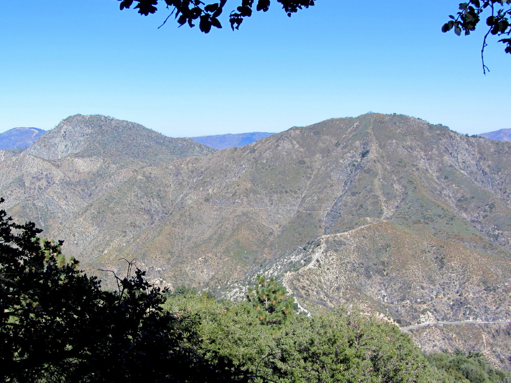
View north from JPL Trail (aka Mt. Disappointment Trail) en route to San Gabriel Peak, Nov. 25, 2011. Stawarberry Peak (6164') (left) and Mt. Lawlor (5957') where completely incinerated by the Station Fire and are now reopen to hike. |
With the closure lifted, the Sierra Club Hundred Peaks Section announced in an email on July 9 that the following peaks are now removed from their “Suspended” list:
- 10E Granite Mtn #1
- 10F Rabbit Peak #1
- 10G Iron Mtn #3
- 10H Round Top
- 11A Josephine Peak
- 11B Strawberry Peak
- 11C Mt. Lawlor
The Station Fire began as a result of arson August 26, 2009, near the USFS Ranger Station on the Angeles Crest Highway above La Canada, and burned 160,577 acres, or nearly 251 square miles. It killed two firefighters, Arnaldo Quinones and Tedmund Hall, and destroyed 89 homes and 26 commercial buildings. It also destroyed the historic Vetter Mountain Fire Lookout. The fire was not contained until October 16. It was the tenth largest fire in the modern history of California and the largest in the modern history of Los Angeles County.
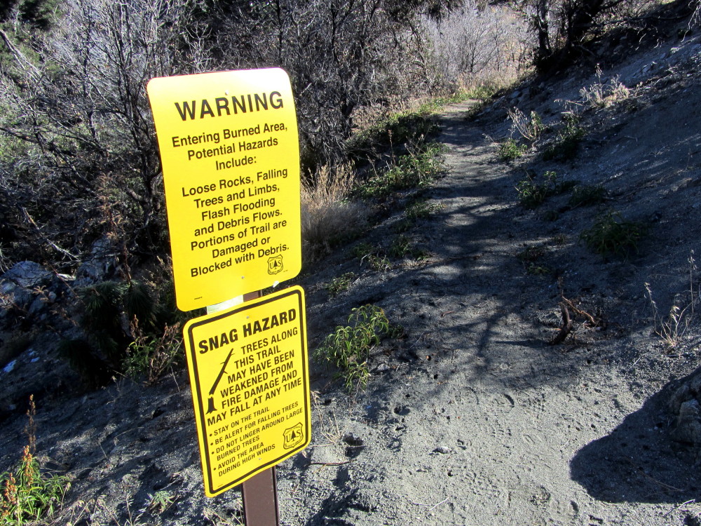 San Gabriel Peak Trail - November 25, 2011 |
Wildfires, Station Fire - at Dan's Hiking Pages
May 20, 2014
Administrative closure of FS3N17 (portion) and axial roads, with map
May 21, 2014
Station Fire Recovery (on Angeles National Forest website)
Angeles National Forest website
Google Map of Station Fire burn area
You may now move freely about Angeles National Forest
By KCPP Staff, 89.3 KPCC Southern California Public Radio, May 23, 2014
Station Fire Articles
Los Angeles Times
Station Fire Burn Scar
Sept. 16, 2009, NASA Earth Observatory
News Stories at Dan's Hiking Pages | Wildfires at Dan's Hiking Pages
![]()
![]() Dan's Hiking Pages |
Dan's Hiking Pages |
![]()
![]() Hiking in the San Gabriels by Dan Simpson |
Hiking in the San Gabriels by Dan Simpson |
![]()
![]() Dan's Hiking Blog
Dan's Hiking Blog
This page was last updated July 17, 2014.