 Hiking Griffith Park
Griffith Park / Los Angeles / Southern California
"It must be made a place of recreation and rest for the masses, a resort for the rank and file, for the plain people. I consider it my obligation to make Los Angeles a happier, cleaner, and finer city."—Griffith J. Griffith
 Griffith Park is an amazing treasure for Angelino hikers, offering more than 50 miles of trails through its thousands of acres of natural terrain. Since coming to work in Los Angeles in 2006, I have come love this wild open space of Griffith Park that sits as an island in a huge sea of urban sprawl. In fact, Griffith Park stands as the largest urban park in the U.S., about five times the size of Central Park in New York City.
This introduction page will give you a big picture view of hiking in Griffith Park. The links to my various trail write-ups will give you detailed information about hiking specific trails. The extensive network of trails throughout the park makes it easy to customize your own hikes by piecing together various trail options.
 Hike Descriptions for Griffith Park
Detailed trail guides including driving directions, recommended season, map, notes, links, and photos
 My Blog Posts for Hikes in Griffith Park
Vivid narratives with photos provide detailed accounts of my various hikes in Griffith Park
-
 Griffith Observatory via East Observatory Trail - August 9, 2007
(Photo Album - 45 photos - My first hike in Griffith Park)
-
Beacon Hill - April 8, 2010 (Hike Report)
-
Bee Rock & Mt. Bell - April 16, 2010 (Hike Report)
-
Glendale Peak, Hogback and Mt. Hollywood - April 30, 2010 (Hike Report)
-
Brush Canyon to Mt. Bell and Bronson Caves - May 6, 2010 (Hike Report)
-
 Ferndell to Griffith Observatory via Western Canyon - May 14, 2010
(Photo Album - 45 photos - Celebrating the Observatory 75 years)
-
Mt. Bell via North Trail Hike - July 8, 2010 (and Amir's Garden)
-
Griffith Park Six Peaks Hike - August 5, 2010 (Bee Rock, Mt. Chapel, Mt. Bell, Mt. Hollywood, Glendale Peak, Beacon Hill via Old Zoo Park)
-
Mt. Hollywood and Mt. Bell Hike - October 10, 2010 (via Griffith Observatory)
-
Mt. Lee and More in Griffith Park Hike - March 9, 2011 (Mt. Hollywood, Mt. Chapel, Mt. Lee, Cahuenga Peak via Griffith Observatory)
-
Mt. Bell and Mt. Hollywood in Griffith Park Hike - October 6, 2011 (via Commonwealth Canyon and Hodback Ridge)
-
Burbank Peak, Cahuenga Peak, Mt. Lee - December 30, 2011 (west approach via Wonder View Drive)
-
Hogback, Glendale, Beacon in Griffith Park - February 17, 2012 (via Vermont Canyon)
-
Chapel, Bell, Hollywood, and Bronson in Griffith Park - February 24, 2012 (via Hollyridge Trail trailhead)
-
Griffith Observatory Space Shuttle Hike - Sept. 21, 2012 (via East Observatory Trail)
-
Beacon Hill, Glendale Peak and Bee Rock - November 21, 2012
-
Mt. Hollywood and Mt. Bell via Brush Canyon - April 12, 2013
-
Mt. Chapel, Mt. Lee, and Cahuenga Peak via Brush Canyon - April 18, 2013
-
Griffith Park Hike: The Los Angeles Zoo - May 19, 2013
-
Mt. Lee Hike in Griffith Peak - June 25, 2013 (via Hollyridge Trail)
-
Western Cyn to Mt. Hollywood & Bell - Sept. 12, 2013 (via Ferndell)
-
Mt. Hollywood and Mt. Bell via Griffith Observatory - Sept. 19, 2013
-
Bee Rock and Mt. Bell via Old Zoo Park - March 13, 2014
-
Mt. Lee via Brush Canyon - April 10, 2014
-
Mt. Hollywood and Mt. Bell via Travel Town - April 9, 2015
-
Burbank Peak, Cahuenga Peak, and Mt. Lee - June 24, 2015
-
Griffith Park Teahouse, Mt. Bell, Mt. Hollywood - July 24, 2015
-
Beacon Hill and Glendale Peak - February 15, 2016 (ascend Beacon Hill via the north ridge trail)
 Griffith Park Maps - A list of links to all the hike maps on this site as well as links to various other maps of Griffith Park Griffith Park Maps - A list of links to all the hike maps on this site as well as links to various other maps of Griffith Park
History
Welch-born Griffith J. Griffith immigrated to the United States in 1865 and eventually made a fortune in California gold mine speculation. In 1882, Griffith settled in Los Angeles and purchased a 4,071-acre portion of Rancho Los Feliz. In 1896, the civic-minded Griffith willed 3,015 acres of his rancho as a Christmas gift to the people of Los Angeles to be used as parkland. Over the years, the park has expanded to its present 4,107 acres through land donations, city purchases, and the reversion of private land to public domain. When Griffith died on July 7, 1919, he left behind a sizable trust to complete the dreams he had for the park.
Terrain and Topography
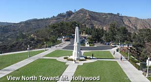
Griffith Park sits in the eastern Santa Monica Mountain range and covers more than 4,107 acres, most of which is natural terrain. The park's elevation ranges from 384 feet to 1,820-foot summit of Cahuenga Peak. The park's complex of ridges, canyons, creeks, springs, and seeps provide for rich diversity in flora (plants) and fauna (animals).
 Trail Types
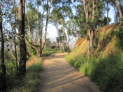
Dirt Roads - When reading about "trails" in Griffith Park, keep in mind that this usually means wide fire roads. If you are a not particularly fond of dirt roads as hiking trails, Griffith Park may be worth an exception.
Conventional Narrow Trails - There are only a few trails in the park which are typical hiking trails (mountain bikers call these single tracks). Examples include Bee Rock Trail, Mulholland Ridge Trail, and Upper Vermont Canyon Trail.
Use Trails - There are many informal trails webbing through the park. They are called "use paths" because they develop by use. In most cases they were not engineered nor are they formerly maintained. Please beware that these paths can pose some risks from steepness, loose footing, and obstructions. And you could end up in someplace where you don't want to be. If you become disabled you may not be readily found by passersby. If you choose to follow these routes, understand the risks, know your abilities, and use a map. And be aware that in some cases use paths also cause erosion damage.
Trail Users
 People - What sets Griffith Park apart from the typical trails that one might find in the San Gabriel Mountains, is that the vast majority of users don't appear to be your typical hikers. For the most part, they are walkers, joggers, doggers, runners, bikers, and equestrians. You will see very few hiking boots, CamalBaks, and the typical clothes and gear that you would see on someone venturing to the top of Mt. Baldy or forging deep into the San Gabriel Wilderness. I suspect you would be hard pressed to find one compass for every 100 trail users. And as I have asked questions of many trail users, I find that for the most part, they don't know the names of trails or peaks or canyons or ridges, nor do they know mileages or elevations. They simply enjoy wandering around their beloved backyard. And that's great!
If solitude is what you are looking for, Griffith Park is not particularly the place, at least on the main trails. When I told a friend that I took a hike in Griffith Park, he asked if I was hiking alone. Well, I was hiking solo, but hardly alone. On that particular Thursday late afternoon there were dozens and dozens of others.
 Dogs - A city ordnance (LAMC 63.44-B,2.C) requires dog owners to keep their dogs on a lease in the park except in designated areas. This ordinance is clearly communicated throughout the park. Unfortunately there are many disrespectful dog owners who violate the law and infringe on the rights of others to enjoy the park. Be assertive in reminding dog owners to keep their dogs on a lease, regardless of how "good" their dogs are.
B-List Hikes
I have thoroughly enjoyed my hikes in Griffith Park and sometimes use glowing language to describe the hikes. However, I would rate hikes in Griffith Park as B-list. For me they are fun to do after work occasionally during the long-daylight season since my office is only about six miles from the park. But on a weekend when I have a chunk of primetime to spend hiking, I most likely would not drive 25 miles to hike in Griffith Park. I'd head to the San Gabriels or San Bernardinos, where the trails are narrower, the topographic grander, and the sense of isolation and wilderness much greater.
If you live near Griffith Park and the park trials are the only hikes you do, I'd encourage you to break out of the rut and try the San Gabriels. I think you may find a rich hiking experience that's a few pegs above strolling around our beloved park. Just a suggestion.
Location:
 Griffith Park lies just west of the Golden State Freeway (I-5), roughly between Los Feliz Boulevard on the south and the Ventura Freeway (SR 134) on the north.
Freeway Exits leading to Griffith Park:
- From I-5: Los Feliz Blvd., Griffith Park and Zoo Drive
- From SR 134 eastbound: Forest Lawn Drive and Victory Blvd.
- From SR 134 westbound: Zoo Drive and Forest Lawn Drive
- From 101 southbound: Exit 9A toward Vine St., merge onto S Hollywood Fwy., continue onto Franklin Ave., drive east to Western Ave, turn left (north) and drive to Los Feliz Blvd.
- From 101 northbound: Hollywood Blvd., turn right (east), drive east to Western Ave, turn left (north) and drive to Los Feliz Blvd.
 Ranger Station and Visitor Center
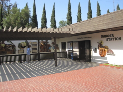
4730 Crystal Springs Drive, Los Angeles, CA 90027 / 323-913-4688
The visitor center hosts splendid nature exhibits and provides maps and other information about the park.
Park Hours: The official park information says, "Griffith Park is open to the public from 5 a.m. to 10:30 p.m. daily. Bridle trails, hiking paths and mountain roads close at sunset."
Griffith Park - Official Website.
|
Links:
- Griffith Park - Official Website. Virtually useless for hikers—no maps, trail descriptions or any anything that provides a clue to where or how to hike in the park.
- Friends of Griffith Park - A non-profit charitable group that promotes the enlightened stewardship of Griffith Park so it can survive and thrive in the 21st Century
- Griffith Observatory - Official Website
|