| |

 |
| |
 |
| |
 |
| |
 |
| |
 |
| |
 |
| |
 |
| |
 |
| |
 |
| |
 |
| |
 |
| |
Dan's Hiking Pages: Hikes in the San Gabriels and Beyond |
|

|
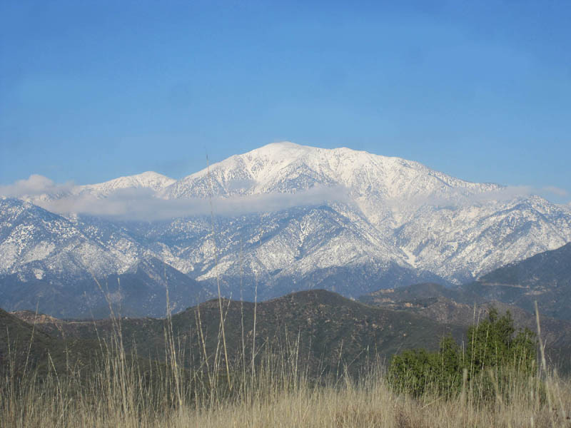 Minding the seasons is an important practice for safely and enjoyably hiking in the San Gabriel Mountains and the Angeles National Forest. It's a common misconception that Southern California does not have seasons, and that misconception often influences the mindset of hikers. But SoCal indeed has four seasons and they make an impact on hiking. The seasons here are not as pronounced as in some parts of the country, and the human sprawl with all its irrigated landscape and air-conditioning tends to make us less conscious of the seasons' impact in the natural environment. But the seasons are real and the wise hiker will pay attention to them.
Key Principle in Minding the Seasons
In a nutshell, here's the key principle to keep in mind: Hike the lower elevation front-range trails in the cooler months, and hike the higher elevation back-range trails in the warmer months. Then be aware of the nuances of transitions between the seasons. It's not rocket science, but I am amazed at how many hikers don't heed this practice. John Robinson puts it like this: "When winter's white mantel closes off the high country, the woodsy canyon and green-velvet foothills become refreshing, delightful, and inviting. And then, in turn, when summer's sweltering dryness invades canyon and foothill, the high mountains once again beckon."
Front Range and Back Range in the San Gabriels
Geographically, the San Gabriel Mountains are generally composed of two parallel ranges running east and west:
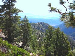
The northern or back range starts roughly at Mt. Gleason (6502') and stretches eastward past Pacifico Mountain (7124'), passes over the 8000 and 9000-foot peaks such as Waterman, Williamson, Islip, Hawkins, Throop, Markham, Baden-Powell, Pine, Dawson, culminates at 10,000-foot Mt. San Antonio (Old Baldy), then swings south over the Three T's and splits toward Cucamonga to the east and Bighorn and Ontario to the west. The back range is great hiking in the warm months.
The southern or front range consists of an assortment of foothills, canyons, and peaks starting roughly at Interstate 5 in the Newhall Pass and running east to San Antonio Canyon above Claremont and Upland. The front range borders the northern edge of East San Fernando Valley, San Gabriel Valley, and West Pomona Valley. Two peaks over 6,000 feet crown the front range: Strawberry Peak (6164') and San Gabriel Peak (6161'). Mt. Wilson (5710'), with its array of communication antennas, is probably the most famous front-range peak, and there are at least 10 others that top 5,000 feet. The front range is great hiking in the cooler months.
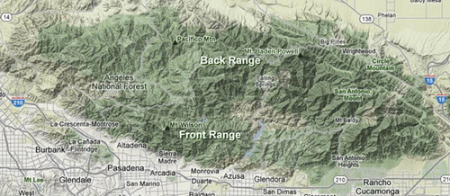
In-between range: Sandwiched between the front and back range are areas which don't conveniently fit into the front-range /back-range configuration. In these cases, it's best to think in terms of elevation. If it is below roughly 6,000 feet, it will generally have the characteristics of the front range. But also consider the plant community; generally the back range will be dominated by large, cone-baring trees (pine, fir, cedar), while the front range is generally dominated by brushy chaparral (with conifers coming in high end). One example of the in-between zone is Smith Mountain (5111') off Highway 39 along the North Fork San Gabriel River. Since it is a half-hour drive deep into the interior of the mountains, it's easy to think of it as back range. But it really has front-range characteristics, and hiking it on a hot summer day can be dreadfully uncomfortable. Heaton Flat Trail in East Fork San Gabriel River is another example of an area with front-range characteristics deep in the interior of the mountains. Usually, a good hike description will give you guidelines for the best seasons of a hike.
Hike Descriptions
Each of my hike descriptions includes a blurb about the recommended season, as do most good hike guides. The recommended season, such as "October - June," is a general guideline as to the best time to hike that trail. It's not hard and fast since weather conditions are variable and you can mitigate some seasonal affects. For instance, on a hot summer day you can begin your hike at the crack of dawn; it doesn't change the brown gunk and dead vegetation, but at least the temperature is more agreeable. Conversely, a high-country hike in the snow can be quite enjoyable with things like proper clothing, equipment, and skills. So carefully consider what the hike description says about season as a key factor in evaluating a hike.
By the Seasons: An Overview of the San Gabriels
The following is a brief overview of the four seasons in the San Gabriel Mountains. It is a general guide to help you get a feel for environmental conditions, but not exhaustive. Be aware of the transitions between seasons. Always check the weather report prior to a hike and look at the season description with individual hike descriptions for any specific details for the trail.
 Spring Spring
(Begins March 20 or 21, which is the spring or March equinox)
- Daylight increases until the longest day of the year, the first day of summer (June 20 or 21).
- Temperatures are generally mild in lower elevations and can still be cold in higher elevations.
- Snow—heavy to light—in the higher elevations can continue to cover high peaks and can be particularly heavy on the north slopes and in shady canyons.
- Rain is possible.
- Skies tend to be clear.
- Vegetation is green, particularly in lower elevations, which can be inundated with non-native grasses and weedy plants.
- Deciduous shrubs and trees are getting their leaves back.
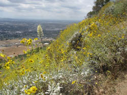
- Flowers are beginning their bloom.
- Waterfalls and steams are flowing from rain and snowmelt (can be beautiful and dangerous).
- Rattlesnakes come out of hibernation and babies are born.
 Summer Summer
(Begins June 20 or 21, which is the summer solstice, longest day of the year)
- Daylight decreases.
- Temperatures are generally hot in lower elevations and less hot in higher.
- Snow on the ground in the early summer is still possible in the higher elevations on high peaks, north slopes, and in shady canyons.
- In the higher elevations, monsoonal thunderstorms with lightning, rain, hail, and gale-force wind are possible, particularly in the later summer in the afternoons.
- Santa Ana wind conditions (strong, dry) can increase the wildfire danger, particularly in late summer.
- Atmospheric visibility in lower elevations can be choked with marine lawyer ("June gloom") particularly in the early summer, and thick, brown haze (combination of marine layer and dirty air) can blanket the southland.
- Non-native grasses and weeds are dead and brown, with the greatest impact in the lower elevations; some chaparral plants are dormant and look parched (reverse deciduous); stickers and burrs can menace the legs and socks on unmaintained trails and off-trail routes; streamside plant communities (riparian) can be lush with full shade.
- Not many flowers are in bloom.
- Waterfalls and streams can be drying up.
 Fall Fall
(Begins on Sept 22 or 23, which is the fall or September equinox)
- Daylight continues decreasing until the first day of winter (winter solstice), shortest day of the year.
- Temperatures are getting increasingly milder in lower elevations and can be getting colder in higher elevations.
- In the early fall, Santa Ana wind conditions (strong, dry) can increase the wildfire danger.
- Snow in higher elevations can come as early as October.
- Rain is possible through spring.
- Skies tend to be clear, particularly after a good storm cleans the air.
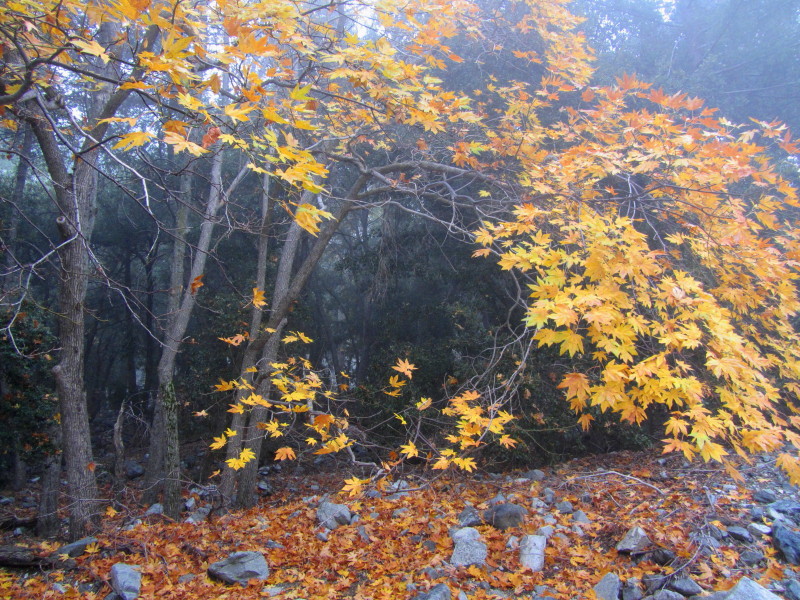
- Non-native grasses and weeds are dead and brown, with the greatest impact in the lower elevations; stickers and burrs can menace the legs and socks on unmaintained trails and off-trail routes; some chaparral plants begin to come back to life after some good rain; streamside plant communities (riparian) can still have lush vegetation while deciduous shrubs (like poison oak) and trees (like white alder and big-leaf maple) begin to display their beautiful autumn colors and lose their leaves.
- Not many flowers are in bloom.
- Waterfalls and streams can be dry until the first good rains.
 Winter Winter
(Begins on December 21 or 22, shortest day of the year (winter solstice)
- Daylight increases until the longest day of the year (summer solstice), the first day of summer.
- Temperatures can be mild to cold in lower elevations and can be freezing in higher elevations.
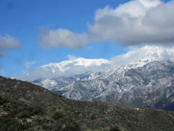
- Heavy snow can be in higher elevations; snow levels can drop down to 3,000 feet or lower in a cold snap.
- Rain is possible through spring.
- Skies tend to be clear but storms can bring cloudy conditions; in the higher elevations, dense, ground-level clouds can completely obscure visibility to within a few feet.
- Winter storms, particularly in the higher elevations, can bring thunder, lightning, rain, hail, snow, and gale-force wind.
- The sun is low in the southern sky which can create deep shade in canyons and north-facing slopes, many of which may be in full sun during the summer when the sun is high in the sky.
- Non-native grasses and weedy plants are still dead and brown, but new growth begins to green up the hillsides; streamside plant communities (riparian) can still have lush vegetation while deciduous shrubs (like poison oak) and trees (like white alder and big-leaf maple) are leafless.
- Not many flowers are in bloom.
- Waterfalls and steams are beginning to flow after the first rains (can be beautiful and dangerous).
Be Prepared
Along with minding the seasons, the best advice for any hiker is to carry the "10 Essentials" and other standard equipment (see my tips page for hiking essentials). Many of the emergency items you carry in your day pack are things you may rarely use, but if you have to use them, it could be the difference of life and death. I think of it much in the same way as things like seatbelts in our cars. A person can go decades buckling up every time he or she gets into the car, yet never be in an accident. But that does not change how important seatbelts are to wear.
Two Scenarios to Consider
On an early Saturday morning in mid August, you roll out of bed and walk outside into the yard. The temperature is pleasant. The lawn is wet from the sprinklers. The garden is lush with vegetation. Beautiful flowers are blooming. You, say, "I feel like going on a hike!" You have some breakfast, throw your gear together, and off you go to the trailhead. You decided to hike to Jones Peak from Bailey Canyon in Sierra Madre. It's a hike you've done several years ago in February and you remember it to be thoroughly enjoyable. You park your car and begin the hike at 10:30 a.m. Soon you leave behind the big oaks, sycamores and green vegetation of the canyon bottom and climb sun-drenched slopes through wilting brush. It's hot now and you're sweating like crazy under the relentless sun. The view toward the vast human sprawl to the south is obscured by thick, brownish gung. Dead grass and weedy stuff line the trail. You trudge the 3.3 miles to Jones Peak. Reaching the summit is an empty victory as you wring with sweat under the blazing sun. Even the plants look miserable. Gnats buzz around your face. What you remember to be such an enjoyable hike before has turned out to be a grueling punishment today. How can that be?
It's all about the seasons!
Another scenario we could describe is hiking into the high country in winter. It's a beautiful, warm, sunny day in the valley, but ice and snow cause trail condition to be treacherous and tedious. Your lightweight clothing is no match for the frigid wind. That wonderful hike you remember from the summer is now a punishment. How can that be?
It's all about the seasons! And minding the seasons is vital for safely and enjoyably hiking in the San Gabriel Mountains.
Personal Reflections
|
|
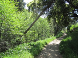
Marshall Canyon - A front range hike green and beautiful in the spring. View Large Image
|
I am on email lists for various hiking groups. It's not uncommon to get an email announcing a hike to a front-range hike like Echo Mountain in the hot summer. And usually the email says nothing about how miserable it will be hiking the sun-drenched slopes in blazing temperatures. This is curious to me that experienced group leaders fail to heed the seasons, and trusting group members just follow their leaders into the furnace. I also get an auto-generated email every time someone posts a comment on the LocalHikes Echo Mt. hike, since I authored the piece. And it's not uncommon to see an entry that says something like, "Really interesting destination with historical ruins, but way too hot!!" Well yeah, it's July! I even heard a veteran Sierra Club HPS leader describe the miserable time she had hiking to a particular lower-elevation peak amid blazing heat, brown hillsides, and gunky skies. She vowed never to return to the horrible mountain. Than at a later time another HPS leader talked her into co-leading a hike to the same peak. This time it was in the spring amidst pleasant temperatures, green hills, blooming flowers, and clear skies. She was amazed at how enjoyable it was. She was totally oblivious to the seasons.
And I have to tell on myself. Years ago when we were new to Azusa, my young son and I decided to hike Glendora Ridge starting at Hilltop Drive in Azusa (back in the days before barbed wire denied public access). It was summer, but I really didn't pay any attention to that since summertime is virtually synonymous with hiking. Furthermore, I didn't even plan the route carefully. I just figured we would hike along the ridge until we found a route descending back to Sierra Madre Blvd and then walk back to the car. Well, as we hiked along the ridge we were baked by the relentless sun. It was horrible. To make matters worse, we were attacked by bees and one stung me right in the forehead. Then we couldn't find a route down. Who knew that rugged, thick chaparral is nearly impregnable without a trail or some blazed route? And we didnít want to turn around to face the bees again. We ended up walking all the way to Glendora Mountain Road then found a doable route cross country to the Big Dalton forest service station. We were miserable, hot, tired, sore, and thirsty. Thankfully my wife came and picked us up. It was a ghastly hike but the lessons were invaluable.
All I can say is, "Hikers, mind the seasons!"
|
|